There are two debates that, I do not know why, but they usually repeat at different moments and forums.
The first one is the classic “traditional book vs. electronic book and/or internet“. I can not contribute so much. Everyone has their own preferences. I love “lose” time at the library (or at Amazon to play it safe and buy one from Lonely Planet) removing all books and buying the book of the next destination that I will visit. But, at the same time, I also understand that not everyone has that need. When people ask me why do I pay for information that can be found for free on the networks, I answer “for romance”. I love do it. I have no more explanation.
The second one, is about if technological advancements are shattering the essence of travel. There are people who say that we have so much information before traveling that the surprise factor has decreased with respect to the trips made by our ancestors. This is true; but it is the only inconvenient. Everything else is advantageous. I am a technologist, a little geek and very organized. I love going out with everything tied up and that’s why I use apps in my mobile that are on fire during the trip. I am happy to see how technology helps me improve the trip!
Before leaving and organizing the trip:
- To decide what to visit within the marked destination, there are many applications that can help us. Lonely Planet Guides, TripAdvisor and Visit a City are the ones that I use the most. Lonely Planet Guides is a city guide with very practical information where everything is classified by theme. It is very complete and I use it a lot; but I will not deceive you… I always buy the physical book! TripAdvisor no needs introduction, but I do feel obligated to say that we should use it to draw conclusions at a global level, but we must always put our own criteria. Visit a City is the great unknown and fantastic at the same time. As a differential feature compared to the others, it proposes routes through cities of different durations (1 day guide, 2 days guide…). Obviously, you also have to browse through travel blogs as Viajeros Callejeros that explain in first person their experience lived for free. There are thousand blogs, but they are my favourites: great travellers and lovely people. I also recommend travel consultors as Bontur. I never go on a trip without talking to them before.
 |
 |
 |
 |
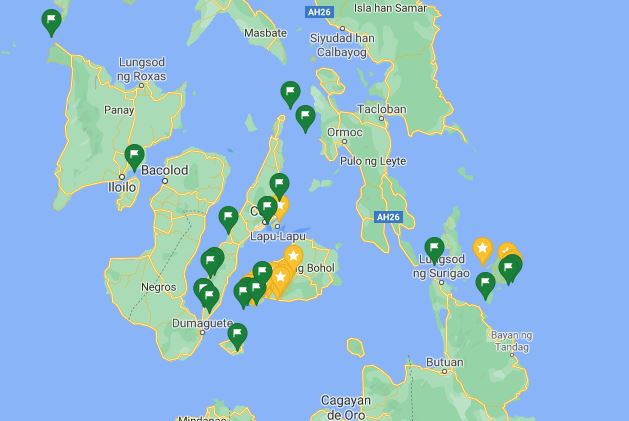
- To plan the route it is very important to mark on a map what you want to visit and that has been decided in the previous point of the list. For that I use Google Maps. Just choose one destination and click on “Save” and “Want to Go”. Doing in this way, is easy to see the geographical location of everything you want to visit. It helps to optimize the time in the displacements (value very appreciated when we go on a trip). When I have already visited the destination and only if I liked it, I change the label from “I want to go” (green flag) to “Featured Sites” (yellow flag).
- To search flights I use three applications: Skyscanner, Kayak y Hopper. The first two are very similar. I only use them to search flights, but they also allow me to search hotels and car rentals. They show the flight options of all airlines with the possibility of filtering the results by number of stops, airlines, flight duration or even departure and arrival times. There is also the possibility of creating alerts to notify us when there are price variations. They are very complete. Kayak dares to give advice to buy or wait depending on the price trend that has occurred in recent months. Hopper is the most different. It has two differential points with respect to the previous ones. The first one is that it does not have a website. It only works with application. The second is that it provides price forecasting, that is, it advises which weeks and/or months the prices will be lower or higher. It helps a lot to know where you have to buy. With these three applications it is practically impossible not to find a cheap flight.
 |
 |
 |
In the destination:
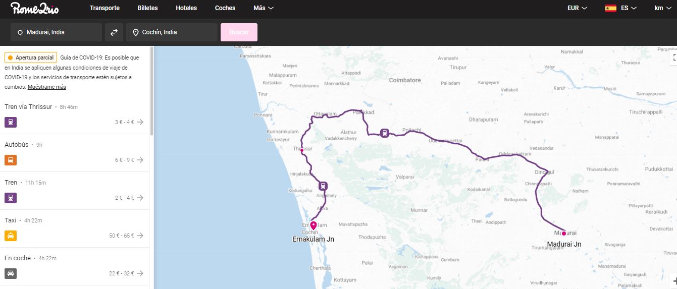
- If you decide to move using public transport, I recommend Rome2rio. An application that I still do not understand why it is so unknown. A simple menu where only the origin and destination are requested and as a result all possible transport options are obtained with the price, time and map information. It is great, very useful and so practical. There is even the name of the companies and the link to buy the tickets online! We can’t forget the power of Google Maps which also gives this information.
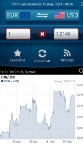
- To facilitate communication with the people of the country and avoid disappointment with the currency exchange, I use the Google Traductor and Currency (there is an App, not web). Honestly, I don’t think either of them has anything special and I suppose there are other better ones on the Internet; but it is true that they are very easy to use and very useful.
 |
 |
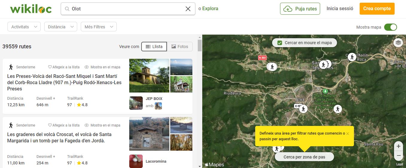
- To enjoy nature and being able to live the landscape with the calm that it deserves, I love using Wikiloc. You can find hiking or biking trails from all over the world. If you do not want to do it when you are traveling because time is limited, it can always be done in your own country. It helps to know the area and to live it differently. The search is very powerful: distance, unevenness, difficulty, circular routes… I love it.
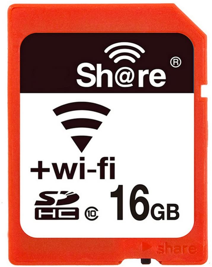
- To protect photos during travel, I use a SD Wifi card in the camara. I connect it to my mobile through Wi-Fi and I copy the photos from the camera to my mobile while I’m on the road. At night, at the hotel, I upload them to the cloud. In this way, I have the photos in three different locations and I do not have to suffer in case I have an accident with the camera.
- To have connectivity at all time, there are gadgets called Mi-Fi. They are small and you just have to put the SIM card of the visited country. It is in charge to distribute Wifi up to 10 devices. For convenience, it is better to leave with the card already purchased. Many travelers talk about “Holafly” to get SIM cards from different countries at a good price and with home delivery. Someday I will try it.
And, to finish and in order to help those who come to look for us at the airport when we return ;-), nothing better than FlightAware. It is a flight tracker where you can see online the location of the plane and the time missing from the flight. Search can be done by flight number, by route or by airport. It shows the alerts, the route map and the moment the plane lands. It is so good.
I hope you find it useful! They help me a lot!




Leave a reply